NOAA hydrographic survey ships and contractors are preparing for the 2022 hydrographic survey season in U.S. coastal waters and beyond.
The agency’s survey ships collect bathymetric data to support nautical charting, modeling, and research, but also collect other environmental data to support a variety of ecosystem sciences.
During the 2022 season, two NOAA hydrographic surveys will collect data related to the Chesapeake Bay watershed.
Approaches to Chesapeake Bay
This project covers 154 square nautical miles approaching the Chesapeake Bay, home to two of the top 20 container ports in the U.S. – the Port of Baltimore, Maryland and the Port of Virginia (Richmond, Norfolk, Portsmouth).
This survey is part of an ongoing, multi-year hydrographic project to support the safety of waterborne commerce to the Chesapeake Bay and transit along the eastern seaboard.
Southeastern Virginia Rivers
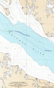
The Potomac, Rappahannock, York, and James Rivers are major tributaries of the Chesapeake Bay. The communities along these rivers are among the oldest in the United States and host a population of over nine million people.
Large portions of these rivers have not been surveyed to modern standards, with the average age of the last survey in many areas exceeding 50 years.
This project will provide modern bathymetric data for safety of navigation and water inundation modeling efforts, from which informed decisions may be made to protect the communities along these rivers.
A fleet of four NOAA hydrographic survey ships; Thomas Jefferson, Ferdinand Hassler, Rainier, and Fairweather are operated and maintained by the Office of Marine and Aviation Operations, with hydrographic survey projects managed by the Office of Coast Survey.
NOAA considers hydrographic survey requests from marine pilots, local port authorities, the U.S. Coast Guard, boaters, and other stakeholders. The agency also considers other hydrographic and NOAA science priorities in determining where to survey and when.
source: NOAA Coast Survey
Leave a Reply
You must be logged in to post a comment.